Climate Monitoring
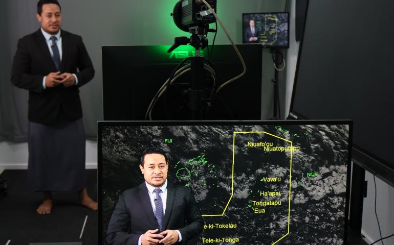
National Meteorological and Hydrological Services (NMHSs) in the Pacific Islands region monitor the state of the global- and regional-scale climate and oceans to assess the likelihood and risk of the formation and movement of tropical cyclones and storms, coral bleaching events, anomalously high seas, the location and intensity of the South Pacific and Inter-Tropical Convergence Zones, and abnormal sea surface and air temperatures. This information is regularly reported to stakeholders alongside national-scale data and sector-relevant impact indicators. The up-to-date global- and regional-scale climate monitoring products below are key resources for this purpose.
Precipitation

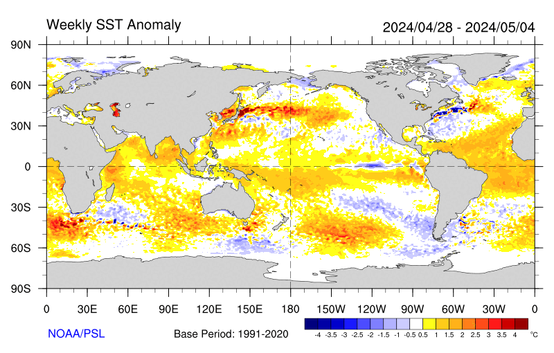
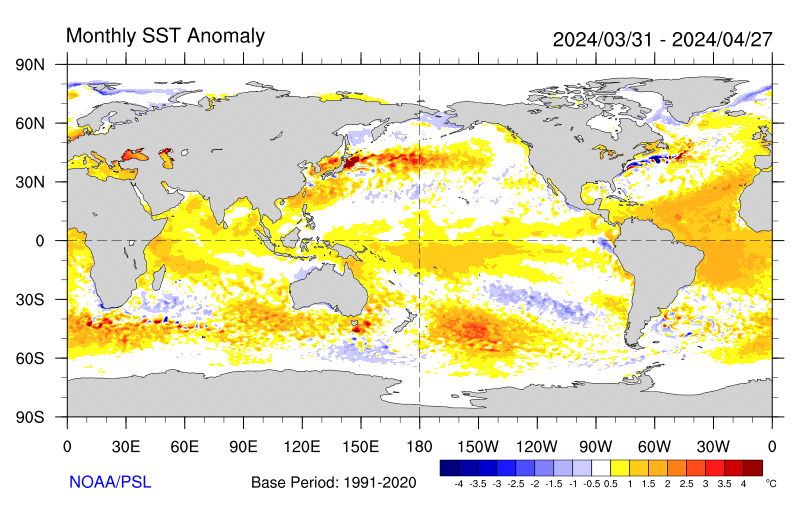
Sea Surface Temperature (SST)
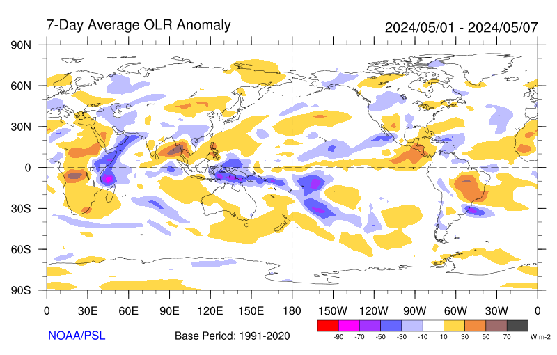
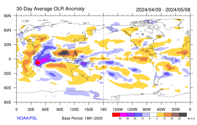
Outgoing Longwave Radiation (OLR)
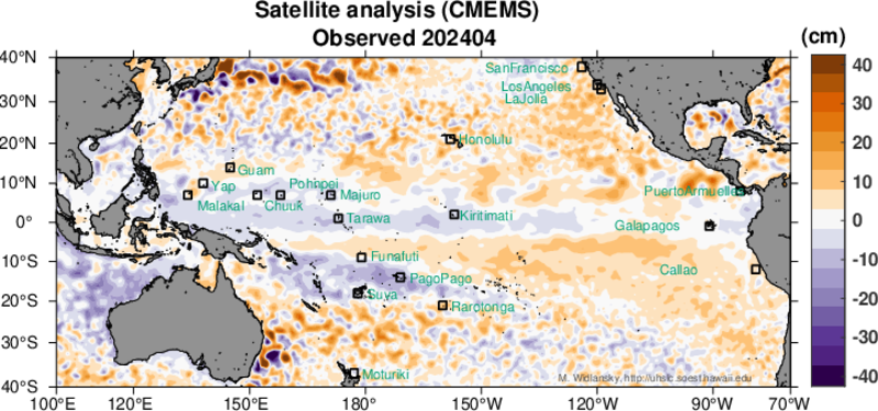
Sea Level
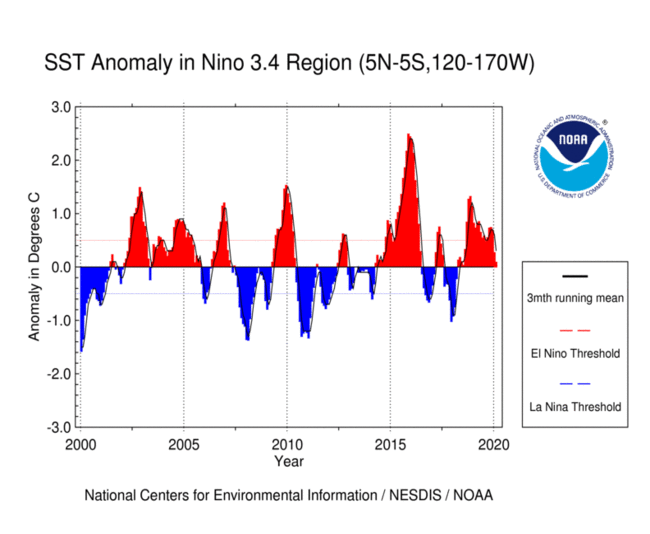
El Niño Southern Oscillation (ENSO)
Air Temperature
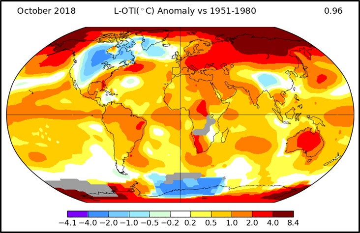 Select parameters on the form to create a surface temperature anomaly or trend map based on Global Historical Climate Network (GHCN) v3 data.
Climate Watches
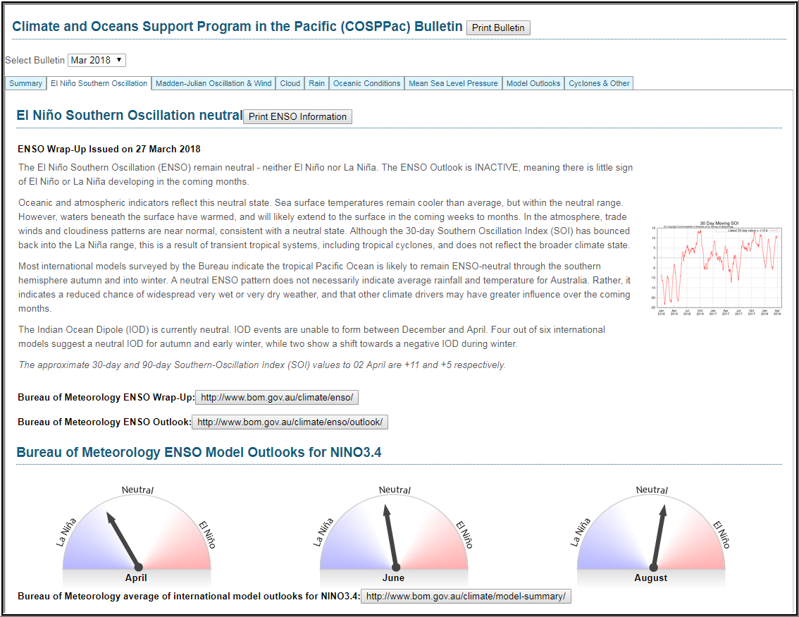 The Climate and Oceans Support Program in the Pacific (COSPPac) Bulletin is a wrap-up of the current state of the El Niño Southern Oscillation (ENSO), Madden-Julian Oscillation (MJO) & Wind, Cloud, Rain, Oceanic Conditions, Mean Sea Level Pressure (MSLP), Model Outlooks, and Cyclones & Other.
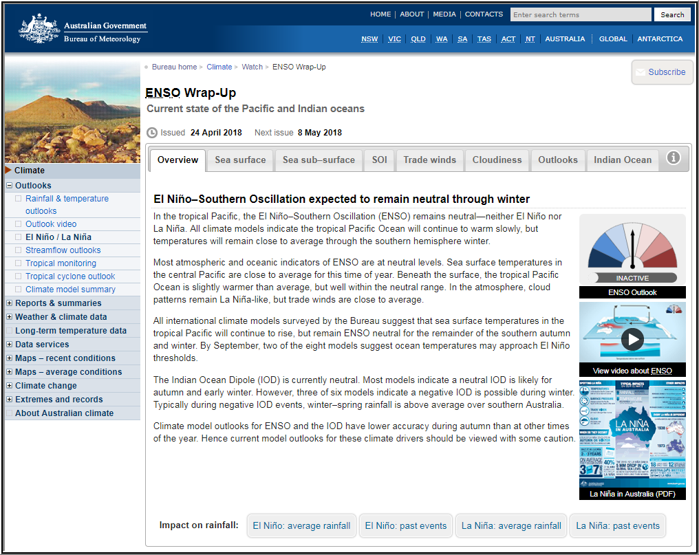 The Climate Drivers Update provides information on the current state of the El Niño–Southern Oscillation based on several oceanic and atmospheric metrics together with the outlook for the next several months.
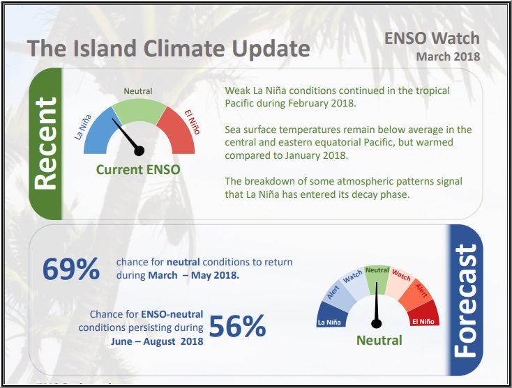 The Island Climate Update (ICU) is a monthly publication which comprises three climate watches for the Pacific Islands region: an ENSO Watch, Rain Watch and Drought Watch.
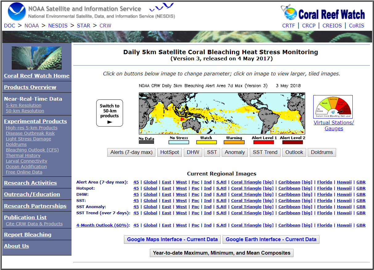 The Coral Reef Watch program uses satellite data to provide current reef environmental conditions to quickly identify areas at risk for coral bleaching. Bleaching is the process by which corals lose the symbiotic algae that give them their distinctive colors. If a coral is severely bleached, disease and death become likely. NOTE: This product is experimental.
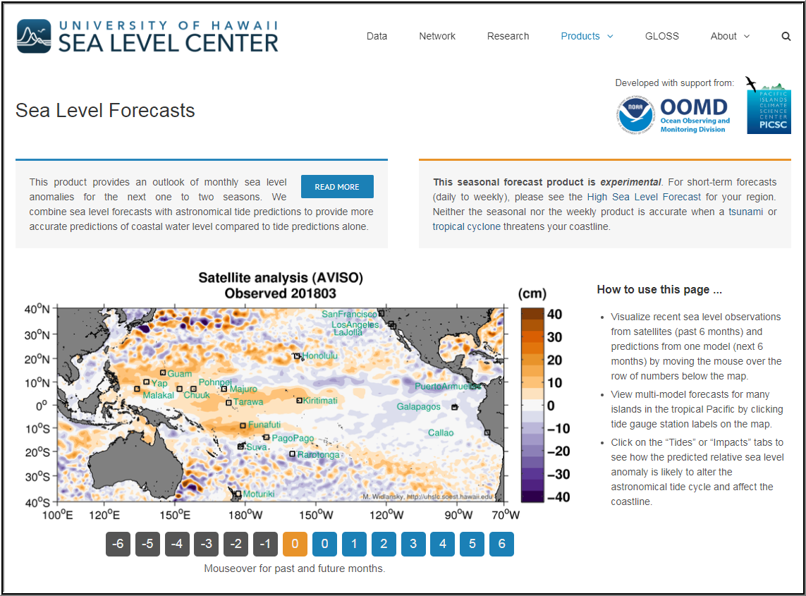 The Pacific Sea Level Ensemble Forecast product provides maps of observed sea level anomalies for the past six months and an outlook of monthly sea level anomalies for the next one to two seasons. NOTE: This seasonal forecast product is experimental.
Exploratory tools
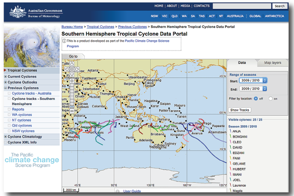 The Southern Hemisphere Tropical Cyclone Data Portal improves knowledge of past tropical cyclone activity in the Pacific Islands and Timor-Leste by plotting tracks of cyclones in the South Pacific from 1969. Meteorologists and stakeholders can use this tool to analyse the tracks of historical tropical cyclones and relate them to the impact on lives and infrastructure recorded on the ground.
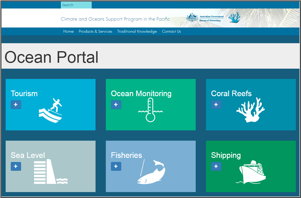 The Climate and Oceans Support Program in the Pacific (COSPPac) Ocean Portal provides ocean information to inform Pacific stakeholders in fisheries, shipping, environmental management and tourism.
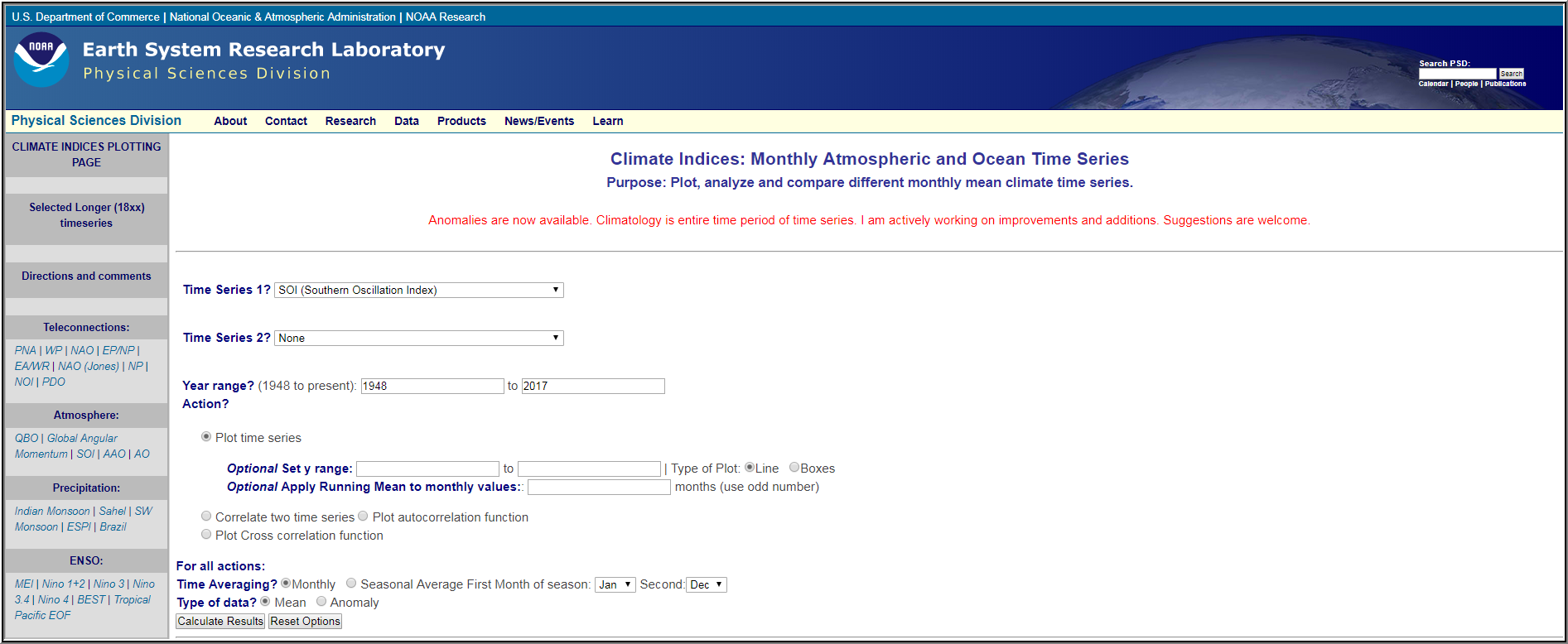 The Climate Indices: Monthly Atmospheric and Ocean Time Series page lets you plot, analyze and compare different monthly mean climate time series.
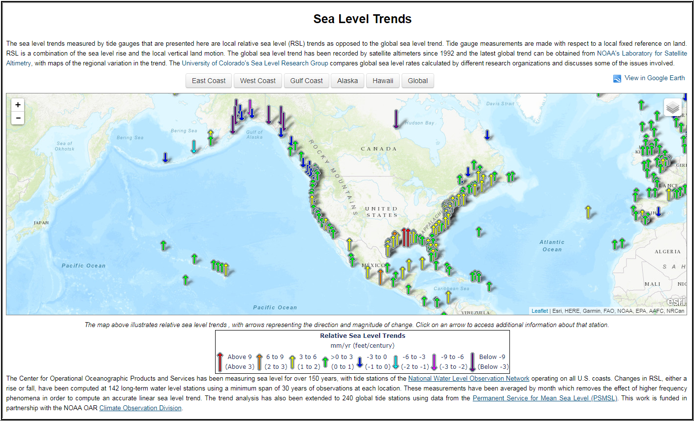 The Sea Level Trends display tool shows local relative sea level (RSL) measured by tide gauges around the world.
Reference climatologies
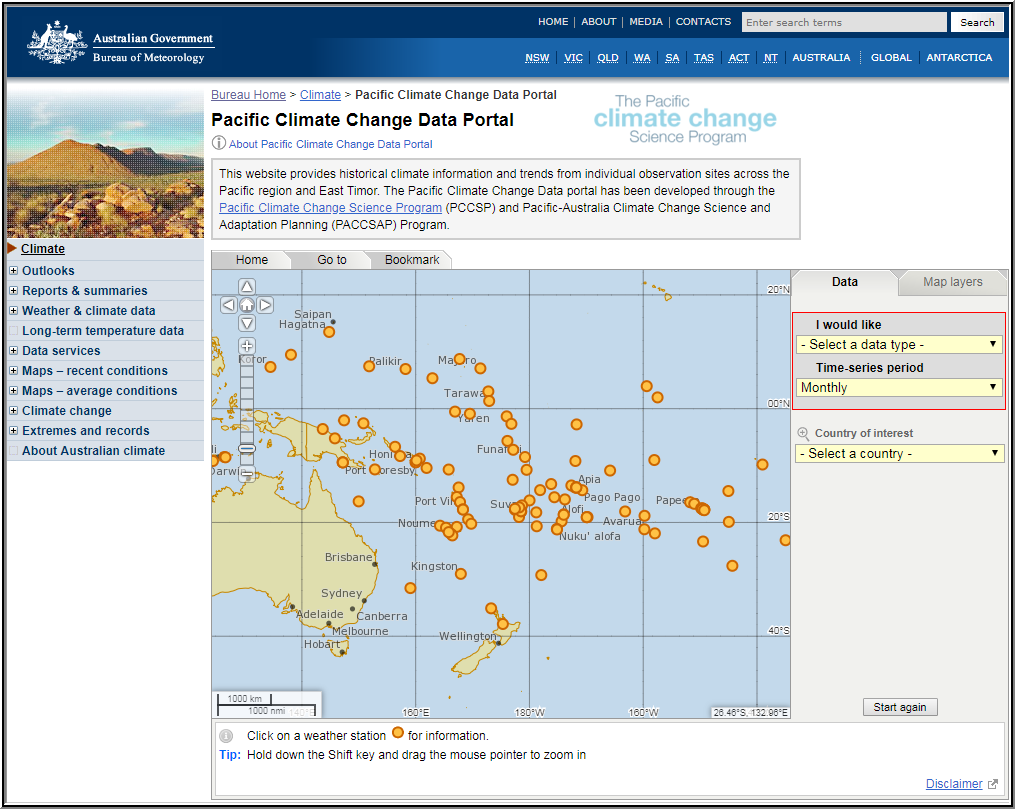 The Pacific Climate Change Data Portal provides historical climate information and trends from individual observation sites across the Pacific region and East Timor.
 An El Niño Southern Oscillation (ENSO) Based Precipitation Climatology for the United States Affiliated Pacific Islands (USAPI) using the PERSIANN Climate Data Record (CDR) [PDF 50 MB].
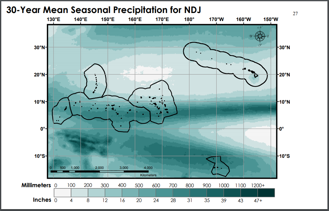
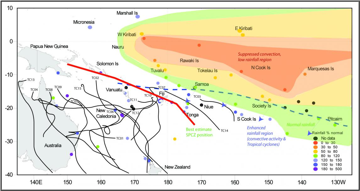 The South Pacific Rainfall Atlas (SPRAT) uses Pacific Island rainfall data to generate historic seasonal rainfall anomaly maps for the Southwest Pacific Islands, based on the 1961-1990 average.
Climate change monitoring
 The Pacific Climate Change Monitor describes variability and change in Pacific Island climates, drawing on the latest meteorological and oceanographic data, information, and analyses.
 The State of the Climate in the South-West Pacific in 2022 provides a snapshot of climate indicators including temperatures, sea level rise, ocean heat and acidification, and extreme weather events in 2022.
 The Pacific Islands Regional Climate Assessment is a collaborative effort to asses climate change indicators, impacts, and adaptive capacity of the Hawaiian archipelago and the US-affiliated Pacific Islands (USAPI). Country-specific reports are available for the Federated States of Micronesia, American Samoa, The Commonwealth of the Northern Mariana Islands, Guam, and Palau.
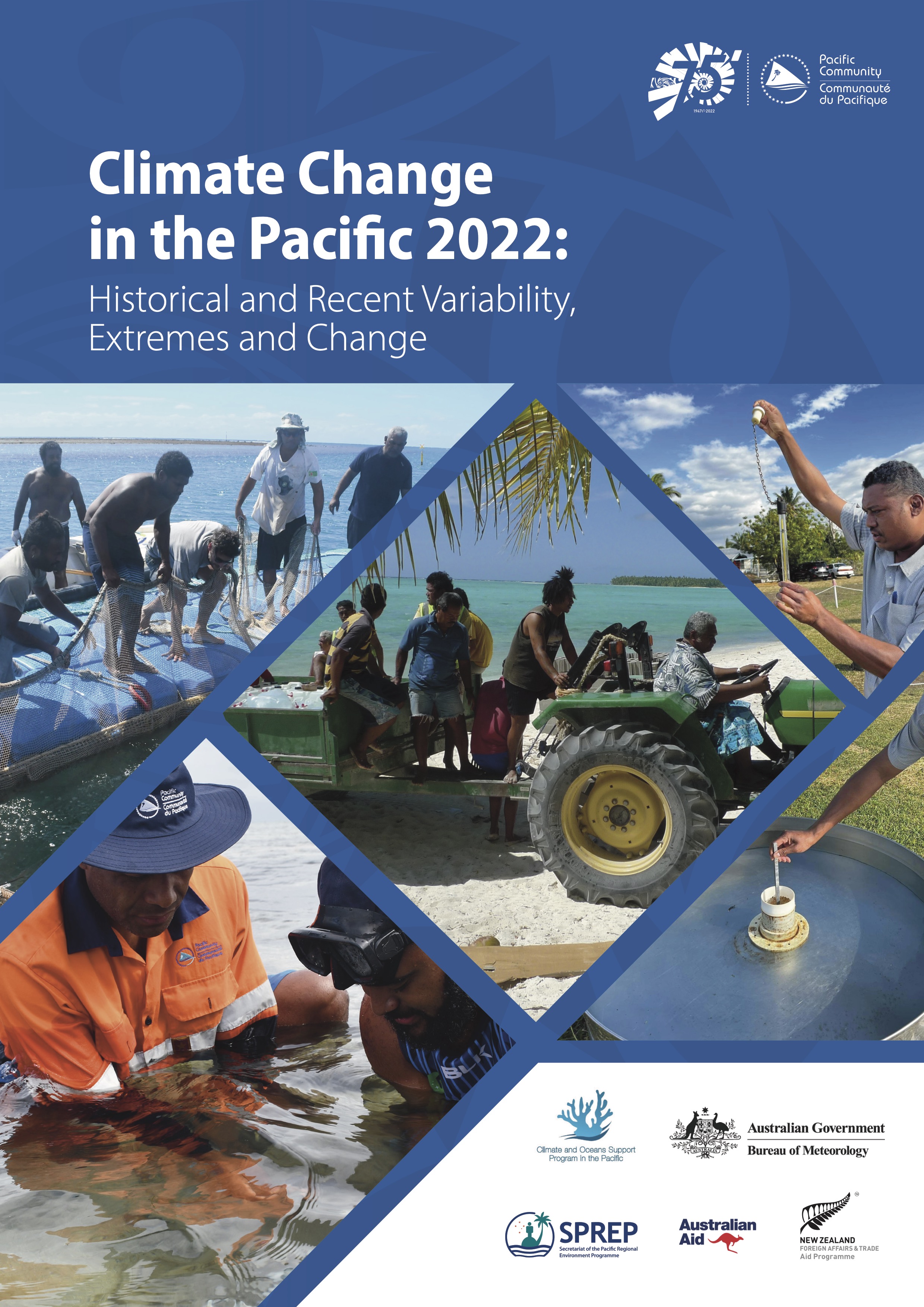 Climate Change in the Pacific 2022: Historical and Recent Variability, Extremes and Change. This report provides an update of scientific understanding of large-scale climate processes, variability and extremes in the western tropical Pacific.
Climate Monitoring Node Leads: NOAA and UHSLC
Consortium members: BoM, SPREP, SPC, NIWA